
When I first started learning about celestial navigation as a wee tot, everyone stressed how difficult it was, and how much math was involved. I’m learning now, that it’s all about the approach. We’ve already done half the work, figuring out Longitude: how far East or West we are on the globe, now we enter Latitude: how far North or South we are.
Longitude
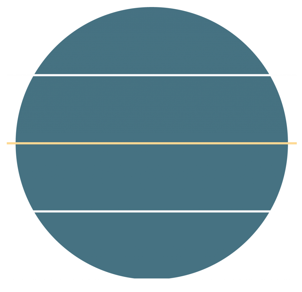
Longitude splits Earth into slices, like an orange, centered around it’s vertical center. Latitude, however is drawn like Earth is wearing a horizontal-striped shirt. Where are these imaginary lines even coming from??

Imagine the core of Earth. Lil’ buddy. And now imagine Earth’s bellybutton: The exact center of the world (basically, I am aware that the Earth is super lumpy and the core is liquid, but apparently math has figured out some “good enough” measurements that make this allll okay).
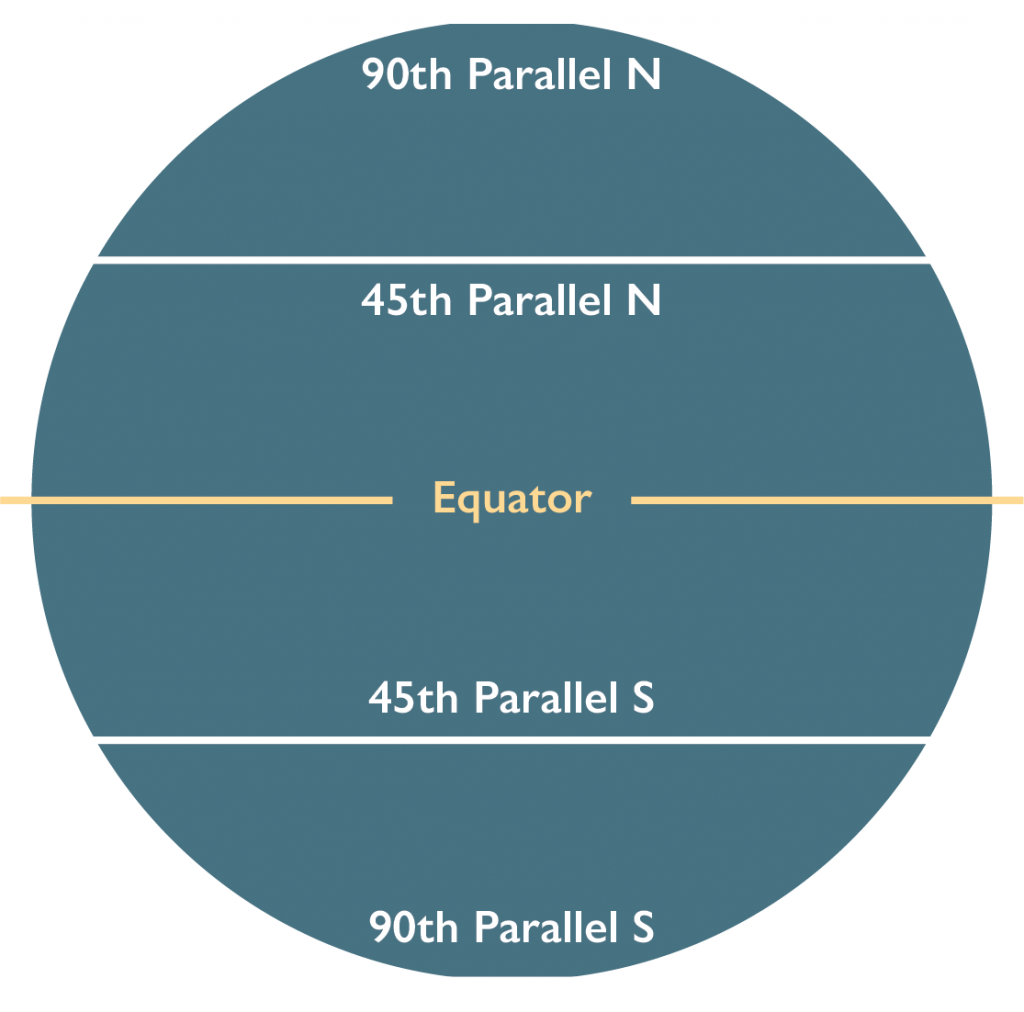
Drawing a straight, horizontal line from the bellybutton to Earth’s surface, you get The Equator or 0° latitude.
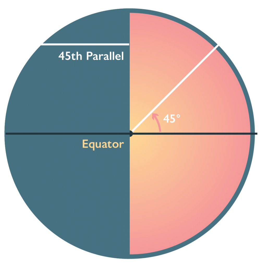
Drawing another line out at an angle to Earth’s surface, gives you another line of latitude, parallel to The Equator. We name these lines based on their angle in relation to The Equator. Since each line of latitude is parallel to the others, they are referred to as Parallels (we hear a lot about parallels when it comes to historic wars, because they were often fighting about border disputes).
This angle is how we refer to how far North or South we are on the globe, and it’s the answer I’m looking for when I make my celestial navigation calculations!
How does this angle extend to the stars? We’ll chat about that next time!