On my mapping adventure, the compass is the real star of the surveying show!
With a compass you can:
– Find horizontal angles (super important)
– Calculate which direction you’re facing
– With an extra-fancy compass, you can also measure vertical angles accurately, so you can find elevations (the height of a feature) or even calculate where you are on the globe, using the angle of the sun, and a few other calculations
Pretty handy right? My compass is very cheap, not terribly accurate and most of the features are for decoration:
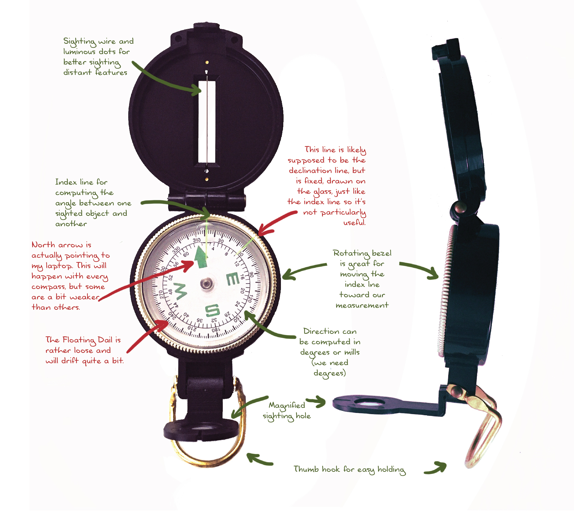
Fortunately, I’m using 15th Century techniques, and the compasses available in that era were rather good, but not phenomenal.
I would suggest using something a little better than the little free compasses you get attached to things, but you don’t have to go for an expensive compass, at least for ancient methodology. I do recommend that you pay for a real compass if you’re going orienteering!
I’ll do a full demo on how I use the compass in surveying, once I head out to the hills!