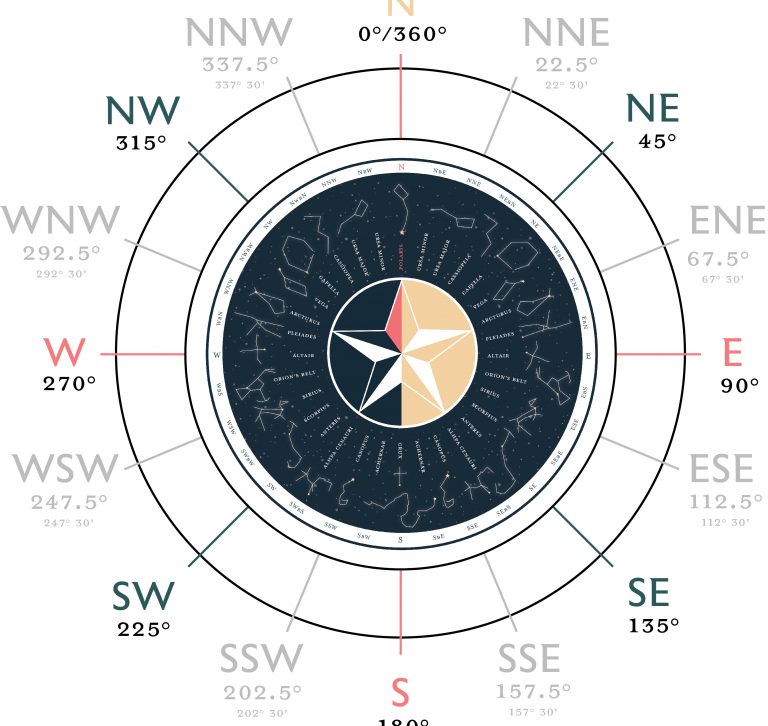
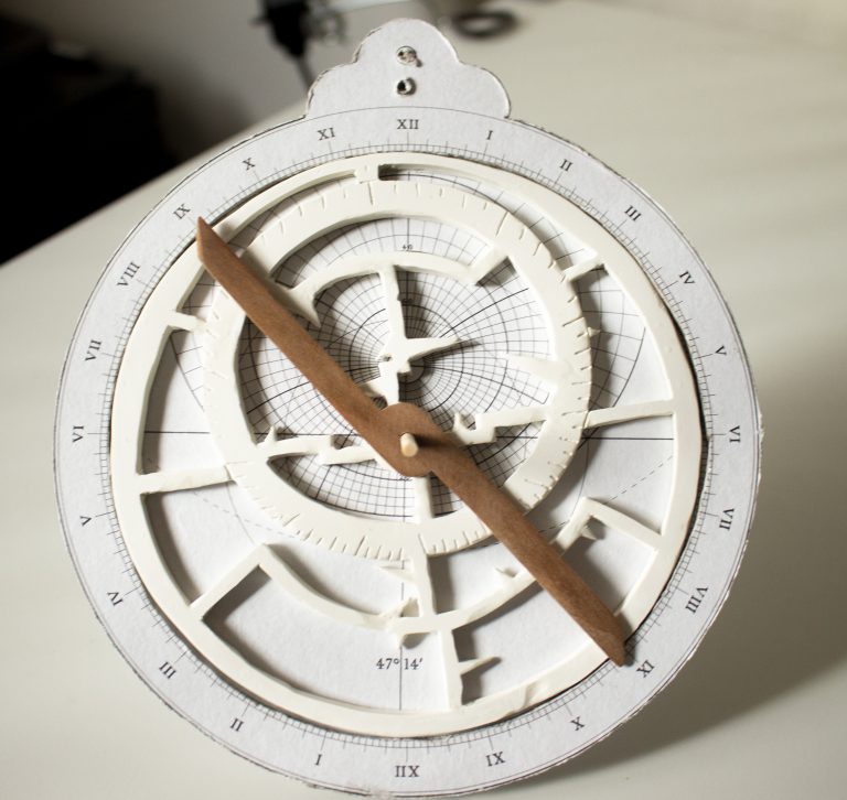
Blog

Star Math – North

Hello. We’ve just been chatting about finding your way around this big, beautiful world of ours. And it’s not just about finding your way, but about feeling secure in where you are, and the journey you’re going on. Last time we explored the direction circle, or what degrees mean in relation to turning around. Now …

Star Math – Where Am I?

If you’ve never read Norton Juster’s The Phantom Tollbooth, it’s full of unexpected life truths. Essentially, Milo, a little boy bored with life, blithely embarks on an adventure where he meets extraordinary people and creatures. At one point, he encounters Alec, a boy that was born in the air and grows from his adult height …

New mini-series! Star Math

Due to a mysterious construction project, I am unable to get out to the site I’ve been mapping. So I decided to kick off a small navigation series in the meantime! I will be focusing on celestial navigation, a topic that I will be learning right along with you, as well as exploring some natural …

Mapping the Reserve, Day 4

Conditions have not been great for conducting a survey, heat smoke, and now the local peoples are carrying out some sort of construction project. But it’s been a great time to get some practice in, sighting horizontal distances! There’s some math involved, but it’s actually very simple and requires only one formula. Using an astrolabe …

Mapping the Reserve, Day 3

That’s right! One of the reasons why maps looked so wild in the medieval era, is that science was sort of on pause. The gaps in knowledge were often filled with reports from sailors or whatever the cartographer could imagine a place would look like. Even toward the end of the century, when measurement tools …

The Math

I was running calculations, and wondered… what was running calculations like in the 15th century? This was the end of the Middle Ages, so we certainly didn’t have calculators or computing machines yet. The Basics Sailors of the Middle Ages were running fairly simple arithmetic, so they’d mostly rely on head or finger math. You …

Mapping the Reserve, Day 2

Day 2 became days 3, 4, 5… I’ve learned a lot about this tiny patch of green over the past few weeks! There seems to be a weird Bermuda Triangle situation going on with part of the trail. All of my compasses go wacky, and I have to start over. Furthermore, since I can’t pin …

Mapping the Reserve, Day 1

Heading out on the first clear day, I thought it would be wise to take the whole area first, staking out the boundary lines. I started on one edge, and picked out a defined marker, as the forest seemed to stretch on wildly beyond that point. I used a method of measuring by gait, where …

Mapping Tools, Part 3: The Astrolabe

My next two tools have to do with measurement! When you do official land measurement, it’s important to use pre-measured chains or ropes that you can lay down evenly. For informal mapping though, it’s easy enough to either use a pre-measured length of rope OR… The power of feet! I actually measured my gait by walking …